証言・写真資料
Testimonies and Photographs
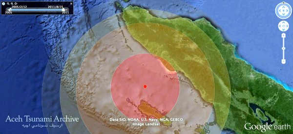
「アチェ津波アーカイブ」では、津波災害を生き延びた被災者の証言や、被災直後から収集された写真を、Google Earthの立体地形に重ねて閲覧することができます。
In "Aceh Tsunami Archive", testimonies of the disaster victims and photographs collected after the tsunami disaster can be browsed on the 3-D geographical feature of Google Earth.
証言資料
Testimonies
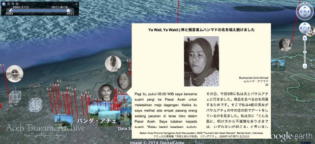
証言資料は顔アイコンで示されており、クリックするとバルーン内にインドネシア語・日本語併記で抄録が表示されます。フッタから、証言の元データ(PDF)にリンクしています。証言資料はアチェ州文書館編「津波と彼らの物語」(2005年10月発行) に掲載されているものから、和訳が完了したものについて、順次掲載していく予定です。
Testimonies are shown by face icons. When a user clicks one of them, an abstract will be displayed by Indonesian and Japanese parallel entry in a balloon. And also, a hyperink to the full data (PDF) of testimony is available. The data of testimonies those translation completed will be published.

写真資料
写真資料は空中のアイコンで示されており、クリックするとフォトオーバレイとして、あるいはバルーンとして表示されます。さらに画面左上のタイムスライダーを操作することによって、時系列に沿った絞り込み表示が可能です。また、Google Earthにも過去の衛星画像が収録されているので、津波前後の変化、そして街が復興していくようすを、時空を越えて体感することができます。
Photographs data are shown by icons in the air, and are displayed as photo-overlays or balloons. The narrowing-down display in alignment with the time series is available by a time slider. Since past satellite imageries is recorded on Google Earth, users can feel the change before and behind tsunami, and revival of the town beyond space-time.
バルーンに表示される写真資料は、制作メンバーの山本・西が中心となって収集したものです。また、フォトオーバレイは各国のニュースサイトに掲載されている写真をハイパーリンクして表示しています。
Photographs displayed on balloons were collected by Yamamoto and Nishi. And photographs displayed as photo-overlays were hyperlinked from original news websites.


その他の資料
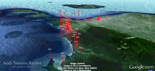
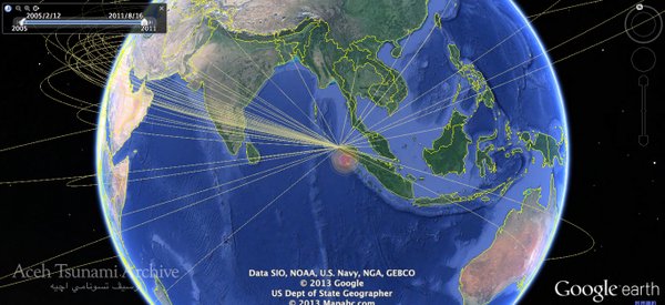
津波遡上高、世界から現地に届いた支援の手をあらわす光の線などの多元的な資料が掲載されています。今後、さまざまなデータを掲載していく予定です。津波遡上高のデータは、藤間功司氏(防衛大学校)のウェブサイトに掲載されているkmzデータを元に作成しています。
We collected pluralistic data in this archive. For example, bar-graph of tsunami ascension quantities, lines showing supporting nations, and so on. The data of tsunami ascension quantities was created based on KMZ data published on the website of the National Defense Academy.


