


iPhone ARアプリ
AR Apps for iPhone
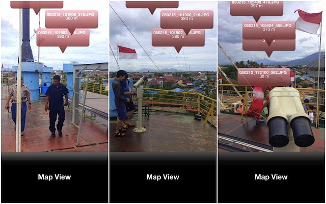
位置情報に基づいて、アーカイブの資料をiPhoneのカメラビューに重ねて表示するARアプリも公開準備中です。バンダアチェでは、被災後10年近くが経過し、過去の被害のようすを想像することは、難しい状況にあります。このARアプリの目的は、現在の風景に過去の資料を重ねあわせることによって、被災状況を実感を持って伝えることです。
AR apps which displays data of archive on the camera view of iPhone based on GPS information is also under preparation. In Banda Aceh, it is difficult to imagine the situation of the past damage because ten years passed after disaster. The purpose of this AR apps is to show a realistic disaster situation to users by overlapping the past data and the present scenery.